
Walk a Benton County Street
A sound Benton County address search moves from place to record, then from record to proof. Start with the exact address as written today. County Property Information can return the parcel, subdivision, lot, block, section-township-range, current deed reference, and linked plats. That result establishes the land unit. It does not establish a full household. The assessor adds the named owner, a separate mailing address, transfer history, and homestead status. Matching situs and mailing addresses can support an owner-occupancy inference, but it is still not a list of everyone who lives there.
Use this street-by-street sequence so that each claim rests on the right source:
- Enter the street address in Benton County Property Information. Save the parcel ID, legal description, and current deed reference.
- Open the county parcel viewer. Identify the address, select its result row, open Spatial, choose Parcels, and use Intersect By.
- Check the assessor record for owner, situs, mailing address, transfer history, and homestead. Treat these as owner evidence, not a household roster.
- Follow the current deed into the recorder index. Search each seller as an earlier buyer while checking the same legal description.
- For past occupants, turn to dated city directories, census records, newspapers, and Sanborn maps. A period source should use the street name current in that year.
This process also gives a stopping rule. If the trail yields only a common name or an owner with a different mailing address, do not call that person a current resident. Seek another dated source tied to the same parcel or address.
Benton County Address Search Fields
The county's combined property search is the fastest official doorway into the address records. Its single field accepts a name, address, or parcel ID. The parcel viewer then adds spatial tools for a whole row of lots. These are separate tasks: the text search locates a known parcel, while the map tools let a researcher select or buffer land along a street.
| Portal control | Kind | Needed | Benton County use |
|---|---|---|---|
| Enter Name, Address, or Parcel ID | Text | Yes in practice | Combined Property Information query |
| Search | Dropdown, text, button | Mixed | Parcel viewer text lookup |
| Identify Layers | Dropdown | No | Selects the layer to inspect |
| Point, Polyline, Polygon | Map mode | No | Draws a spatial selection |
| Buffer Distance and Units | Text and choice | No | Uses feet, miles, or meters around a selection |
| Spatial Layers | Dropdown | No | Targets Parcels or another layer |
| Intersect By or Contain By | Buttons | No | Returns spatial matches |
The GIS result may show owner, address, acreage, districts, deed book and page, survey plats, lot, block, and subdivision. The assessor remains the better source for the separate owner mailing address, values, and homestead. Neither portal should be treated as a legal survey.
Benton County Street Record Layers
No Benton County address source is complete by itself. The sources overlap, but they do not say the same thing. A parcel is a mapped unit of land. A situs address is the physical property location. A mailing address is where the tax contact receives mail. The deed and legal description control title questions, while GIS supplies useful, nonauthoritative geography.
| Address record | Custodian | Street evidence | Access route |
|---|---|---|---|
| Assessor roll | Benton County Assessor | Owner, situs, mailing, transfer, value, homestead | Free ARCountyData search, counter, phone, email |
| Property Information | GIS and Assessor | Parcel, owner, address, deed, plats, lot and block | Free county web search |
| Parcel map and downloads | Benton County GIS | Roads, addresses, parcels, cities, annexations, subdivisions | Viewer, basemap, CSV, monthly downloads |
| Land index and images | Circuit Clerk/Recorder | Title parties, instruments, liens, legal descriptions | Paid web images, office books, written request |
| Permit files | County or city building office | Project address, applicant, work, inspections, dates | Portal, counter, or records request |
| Period directories and maps | Rogers Museum and archives | Dated contact, business, structure, street clues | On-site research and selected digital collections |
The parcel ID and legal description are the best links across systems. Street text can change. A recorded deed can also prove a recent transfer before the assessor roll catches up. When online data conflicts, the controlling document comes from the Recorder, not the map.
Note: Benton County GIS data is useful for research and selection, but its own disclaimer keeps it from serving as survey evidence.
Browse Benton County Streets in GIS
The parcel viewer can turn one address into a repeatable street study. Click adjacent parcel polygons for a small set. For a wider selection, draw or select the target area, add a small buffer in feet, choose Parcels as the spatial layer, and run Intersect By. The result table can be printed or exported as CSV. Cross-check the owner names against the assessor because the map is informational and may lag.
The county also publishes roads, addresses, blocks, lots, subdivisions, parcels, cities, and annexations through GIS downloads. Those layers help define a named street without assuming its postal city is its legal jurisdiction. Bentonville and Rogers delivery areas can extend into smaller cities or unincorporated land. City and annexation layers answer that question better than the mailing label.
The Benton County basemap adds Layers, Measure, Query, Search, Draw, and Print controls. Use those tools to inspect the road and subdivision context, then return to the assessor and deed for ownership proof.
Note: Postal city names can cross municipal lines, so use Cities and Annexations layers before choosing a local records office.
Benton County Deeds by Address
The address chain becomes a title trail once the current deed reference is known. The Benton Circuit Clerk land service covers deeds, mortgages, liens, lis pendens, judgments, UCC records, and plats. A grantor conveys property; a grantee receives it. Search today's seller as a grantee in an earlier date range. Check the lot, block, subdivision, or full legal description before accepting the match. Repeat with each prior seller.
The dedicated recorder FAQ gives a deed name-index start of May 3, 1945, while deed images reach January 31, 1933. Before October 30, 2017, documents use book and page. Later land instruments use a number beginning with “L.” The county's shorter summary conflicts with those dates, so early coverage should be confirmed at 479-271-1017. Web image access costs $0.25 per page, with monthly subscription plans also offered.
Online access is not the only route. The Recorder counter at 215 E Central Avenue, Room 202, Bentonville, is open weekdays 8:00 to 4:30, with recording ending at 4:15. Ask for the grantor and grantee books for the target year. A focused Arkansas Freedom of Information Act request may seek an existing nonexempt record by names, dates, category, and instrument reference. For much older work, Benton County Historical Society deed films span 1837 through 2015.
Benton County's 112-Year Bridge
The largest street-search gap is not a records loss. It is an index boundary. The modern deed name index begins in 1945, but the Benton County Historical Society holds printable deed films from 1837 through 2015. Its personal and real-estate tax surname indexes cover 1837 through 1899, and lot-and-block indexes cover 1871 through 1899. Together, those collections create a 112-year bridge from the first tax era to the online index.
That span has practical value. A “no result” before 1945 means only that the modern name index did not reach the year. It does not prove no deed exists. Start with the assessor's current deed reference, work backward online, then carry the exact legal description to the Recorder books or Historical Society films. The society is open Tuesday through Friday, 10:00 to 3:00, without an appointment.
Note: Image coverage and name-index coverage are different; a known book and page may expose a deed that a name search cannot find.
Benton County Address Permit Clues
Permit files date work at a parcel and can explain why an address first appears or changes form. The county building guide calls for the owner, 911-assigned project address, city, ZIP, parcel number, work description, contact details, and owner signature when acting as contractor. When a new purchase has not reached assessor data, the guide requires a recorded deed as proof. That rule documents a real lag between recording and assessment systems.
Municipal access varies. Rogers covers development, lot splits, signs, building permits, inspections, licenses, and payments through its portal. The visible route offers Guest Access, though the exact guest address fields were not captured. The Rogers permit portal is therefore a good address lead, not a fully inventoried index.
The captured Rogers permit portal shows the route into the city system:

That screen helps identify the public entry point. If the guest search fails, contact the responsible city building office or submit a focused request for a known address and date range.
Define Benton County Street Terms
Small wording differences can change the result. Keep these terms beside any by-address notes so a tax contact is not mistaken for an occupant and a map shape is not mistaken for title proof.
- Parcel
- A mapped unit of land identified by the county. One street address may relate to more than one parcel.
- Situs address
- The physical location assigned to the property, as distinct from the owner's mailing address.
- Plat
- A recorded drawing that lays out lots, blocks, streets, or subdivision boundaries.
- Legal description
- The deed's title geography, often based on lot and block or section-township-range.
- Criss-cross directory
- A directory arranged by street and house number. Benton County research did not confirm which local volumes contain one.
The unconfirmed criss-cross point matters. Do not promise a reverse street section in the Rogers shelf. The Benton County city directory collections are best searched in person with staff help and a period address.
Benton County's Renamed Street Trap
Rogers renamed West Capitol Avenue as Founders Way in 2021. A current by-address search under the new name can miss an old directory, permit, newspaper, or map entry. Search each period under the street name used then. Keep the parcel ID, lot and block, subdivision, and deed legal description as stable keys while the street label changes.
Annexation can shift the office that holds a municipal permit or code file without moving the parcel. The Rogers City Clerk keeps landowner-initiated annexation petitions, ordinances, and cemetery deeds. Public inspection is available, and email replies may take two to three business days.
The successful capture below comes from the Rogers City Clerk source:
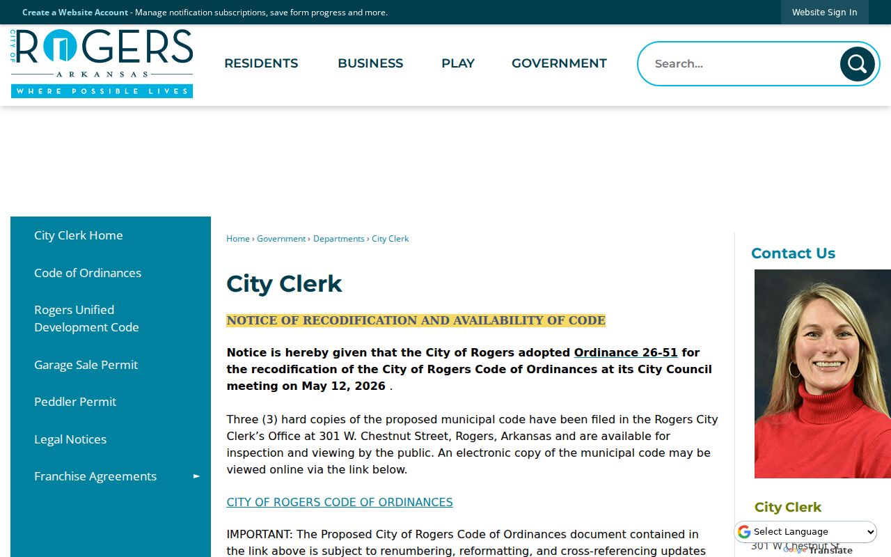
City records can explain a jurisdiction change, but the county deed and legal description remain the stronger links across time.
Benton County Historic Street Evidence
For past occupants, a by-street search moves from title to dated sources. Rogers Historical Museum holds local city and business telephone directories beginning with a confirmed 1904 volume, plus newspapers, obituaries, maps, cemetery and funeral-home material, and name-and-place vertical files. Exact year runs and reverse sections are not published. Ask staff to check the target year and street rather than assume an unbroken shelf.
Sanborn fire-insurance maps help translate an old place. Confirmed editions cover Bentonville from 1886 through 1940, Rogers from 1896 through 1914, Siloam Springs from 1897 through 1948, and selected years for Decatur, Gentry, and Gravette. They show building footprints, materials, uses, blocks, and street numbers, not ordinary resident names. Pair the map with a directory or census record.
A telephone subscriber may be only one adult in a home. A deed holder may never have lived there. The street record trail works best when these sources corroborate each other without being forced into one kind of proof.
Note: Sanborn maps show buildings and use, not ordinary resident names, so pair each sheet with a dated people source.
Benton County Street Directory Limits
Ownership records do not normally enumerate renters or every household member. VoterView is a self-service registration and polling-place tool, not a public browse-by-address list. A released voter file may contain residence fields, but the current request form and terms need verification, participation history never reveals ballot choice, and secure-voter addresses are withheld. Utility customer records and motor-vehicle addresses also stay outside this workflow.
The most accurate result may be limited: a titled owner, a dated mailing contact, or a historical subscriber. State the source and date. Preserve the exact indexed name, including initials, compound surnames, or maiden forms. Where a map and deed disagree, verify with the custodian.
Lawful use. Benton County address records are for lawful personal research. Arkansas law forbids using them to stalk, threaten, monitor, or harass anyone.
A current address search cannot reveal protected addresses, sealed records, private delivery data, or a complete household. Those gaps are legal boundaries, not search errors.