
Benton County Neighbors Sources
A block lookup begins by deciding what “nearby” means. Benton County GIS can define touching parcels, a small radius, a legal block, or a subdivision. The assessor then adds titled owners and tax-contact information. These public systems describe land and public registration facts, not a complete roll of nearby residents. The source and its limit should stay beside every result.
| Block Source | What It Reveals Nearby | Access and Limit |
|---|---|---|
| County parcel viewer | Parcel shapes, adjacency, buffer results, and owner-linked rows | Free and informational, not a legal survey |
| Assessor roll | Titled owner, situs, mailing address, transfers, and homestead status | Free search or counter; no full household roster |
| GIS lots, blocks, and subdivisions | Legal and mapped context for defining the search area | Free viewer and monthly downloads |
| Voter records | Limited public registration fields and election geography | No web browse by street; protected records are withheld |
| Great Neighborhoods Partnership | Registered organization type, boundaries, and public contact path | Voluntary and Bentonville-only; no member names |
| Historic maps and directories | Past structures and named subscribers where a volume exists | Historic only; the directory run is incomplete |
Parcel ownership is the strongest current land fact. It does not prove who sleeps at the address. A separate mailing address can belong to a remote owner, trustee, agent, or entity. Matching situs and mailing plus a homestead mark supports an owner-occupancy inference, yet it still does not name the rest of the household. That line prevents a search for people next door from turning weak clues into claims.
Map Benton County Neighbor Parcels
The Benton County parcel viewer supports a reproducible path from one address to nearby land. It includes point, polyline, and polygon selection, a Buffer Distance box set to 20 by default, Feet, Miles, and Meters choices, a Spatial Layers menu, and Intersect By or Contain By actions. Use feet for a tight block search. A broad radius can pull in parcels across a creek, highway, or subdivision edge that are not part of the same lived block.
- Search or identify the target address and select its result row.
- Open Spatial, choose Parcels, and use Intersect By to capture the selected location.
- For touching and close parcels, select or draw the target, apply a small feet buffer, and run Intersect By again.
- Inspect each result and export the CSV. Keep the parcel ID with the owner name.
- Cross-check every owner in the Assessor roll and note where mailing and situs differ.
Use lots, blocks, subdivisions, roads, cities, and annexation layers to test the boundary. For a full named road rather than the immediate radius, the Benton County street directory follows the longer address and deed chain. A block lookup stays focused on the parcels that surround one starting point.
Benton County Neighbor GIS Export
The county makes roads, addresses, blocks, lots, subdivisions, parcels, cities, and annexations available through its GIS downloads page. Those layers let a researcher save the boundary logic used for a Benton County neighbor search. An exported row should retain the parcel ID and mapped relation, since a loose list of owner names cannot show why each parcel was included.
The captured county GIS downloads page opens with its official disclaimer before the layer list.
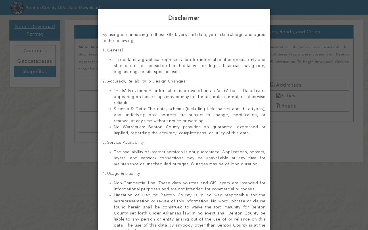
The notice calls the layers graphical and informational, reinforcing the need to check mapped owner names against the current assessor roll.
The county labels GIS information as nonauthoritative. Parcel lines can guide a block search, but they are not a survey and do not alter a deed. The official County Property Information record can add subdivision, lot, block, section-township-range, current deed, survey-plat links, and local districts. Those fields explain the parcel's setting without claiming that each mapped owner is an occupant.
Note: Save the parcel ID with each exported name so later assessor updates can be checked against the same piece of land.
Benton County Neighbor Ownership
The Benton County Assessor Real Estate route adds current ownership, situs location, a separate owner mailing address, deed transfers, land and building details, valuation, assessment history, and homestead status. These facts can support a narrow statement: the roll names the titled owner and tax contact tied to a parcel. They cannot supply all nearby residents who may live there.
- Parcel
- A mapped and assessed unit of land with its own identifier.
- Situs address
- The physical location assigned to the parcel.
- Mailing address
- The destination for the owner's tax mail, which may be somewhere else.
- Homestead status
- A property indicator that can support, but never prove by itself, a primary-residence link.
Trusts, estates, companies, and out-of-area owners need care. A deed can identify title parties, and probate or a public business filing may explain the name on the parcel. None of those sources should be used to invent a private household roster. Benton County describes its online assessor data as working papers furnished “as is,” so a recent deed may be newer than the roll. The Real Estate Department at 2109 W Walnut Street in Rogers is open weekdays from 8:00 to 4:30 and can be reached at 479-271-1037 or realestate@bentoncountyar.gov.
Benton County Neighbor Voter Limits
Arkansas VoterView is a self-service registration and polling-place lookup. It is not a browse-the-block tool. State guidance uses a person's name and date of birth for a status check. A separate statewide policy described released files with name, county, voter ID, residence or mailing address, phone, date of birth, precinct, districts, and participation history, but the direct request form was stale and must be reverified with the Secretary of State.
Participation history indicates that someone took part in an election. It never shows a ballot choice. Arkansas also does not ordinarily register voters by party, so a primary event must not be used to assign a belief. For a Benton County neighbor lookup, these limits are as important as any visible field.
Secure-voter status under Arkansas Code §7-5-112 removes address information for qualifying domestic-violence victims. Amendment 51 also protects specified fields. A protected person's absence is not evidence that the person left the block, and confidential addresses must never be reconstructed from other clues. The Benton County Clerk is the local registrar, with its main office at 215 E Central Avenue in Bentonville and phone 479-271-1013.
Benton County Neighbor Associations
Bentonville's Great Neighborhoods Partnership helps test whether a registered organization covers an address. Its registration fields include an organization name, type, north, south, east, and west boundaries, map upload, household count, and communication methods. Accepted types include a newly forming association, an existing association, a property owners association, and a homeowners association. The record describes an organization, not its members.
| Community Route | Coverage | Public Contact or Limit |
|---|---|---|
| Bentonville Great Neighborhoods | Voluntary registered groups within Bentonville | neighborhoods@bentonvillear.com; boundaries and organization contacts, no member roster |
| Registered association types | Forming groups, existing groups, POAs, and HOAs | Registration can show type and communication methods, not private identities |
| Rest of Benton County | Rogers, Bella Vista, Siloam Springs, and unincorporated areas | No authoritative countywide HOA or POA inventory was verified |
| Historical organizations | Local historical and preservation groups | Public organization contacts only; no public member rolls were verified |
The captured Great Neighborhoods page shows the official Bentonville starting point for association boundary work.
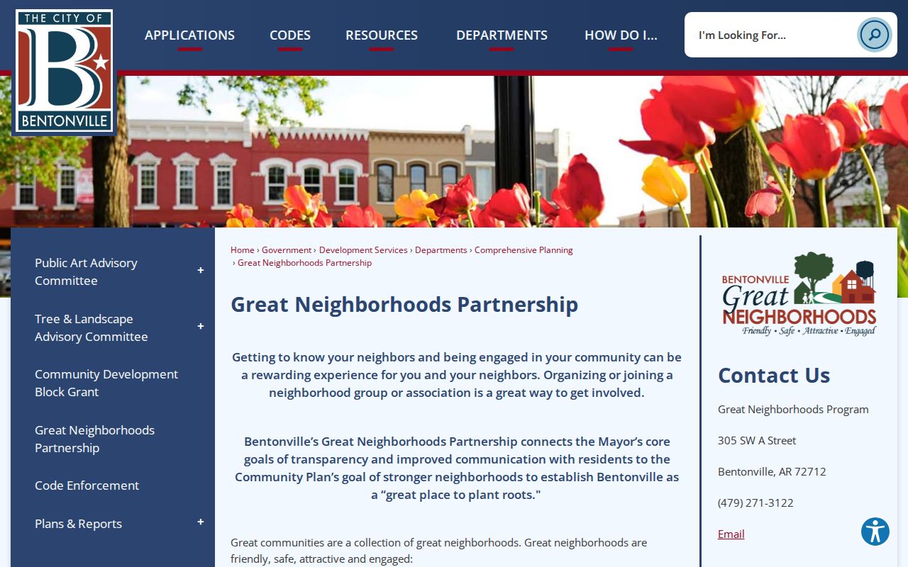
It is useful for finding a public organization contact while leaving private household and membership details outside the lookup.
Official Benton County Neighbor Tools
Official rolls and commercial neighbor tools answer different questions. The official sources are narrower, but each field has a named custodian and a defined public purpose. A commercial compilation may combine old addresses and third-party data with no clear update date. Speed does not cure a stale or merged identity.
| Measure | Official Benton County Sources | Commercial Category |
|---|---|---|
| Land boundary | Parcel, lot, block, and subdivision layers | May use simplified or old map data |
| Owner identity | Assessor roll checked against recorded deed | May merge owner, prior address, and other people |
| Correction route | Assessor, GIS, Recorder, or Clerk by record type | Provider-specific process |
| Protected data | Secure and confidential records withheld | Suppression quality varies |
| Best use | Civic, property, and personal block research | Lead only, requiring official confirmation |
Start with GIS because it defines which parcels are actually near the address. Then check the assessor and, when title matters, the deed. If a commercial result conflicts, correct the source that is wrong rather than copying the conflict into a block list. No tool should be used to fill protected or private gaps.
Benton County Historic Neighbor Blocks
Sanborn fire-insurance maps offer a different view of old Benton County blocks. Verified editions cover Bentonville from 1886 through 1940, Rogers from 1896 through 1914, and Siloam Springs from 1897 through 1948, with additional editions for Decatur, Gentry, and Gravette. They show building footprints, materials, street and block numbers, and uses. They do not show today's nearby residents or name ordinary occupants.
Rogers Historical Museum confirms local directories beginning with a 1904 edition, but an unbroken run and reverse-section dates were not published. A directory can help identify a named subscriber near an old address when the right volume survives. The 1903 county atlas and original plats help anchor that evidence to land. Street history still needs translation: Rogers changed West Capitol Avenue to Founders Way in 2021, and annexation can change city jurisdiction.
Historical blocks should be kept apart from the present roll. A period map can show that a structure existed or that a lot carried another number. A later directory can add one named account holder. Neither fact establishes the current household. Dates, map edition, directory title, and exact address form belong in the citation.
Note: Historic maps explain the block in their own era; they do not identify the people who live around the address now.
Benton County Neighbor Privacy Limits
A Benton County block search should stop where public evidence stops. Parcel records omit many occupants. VoterView cannot browse a street. Secure voters are shielded. Motor-vehicle data is restricted, and private utility or delivery records do not belong in a neighbor directory. Association boundaries are public contact aids, not permission to publish member identities.
Use the narrowest area that answers the question. Save parcel IDs and dates, verify an owner in the assessor roll, and describe the result as ownership unless there is sound independent proof of occupancy. If the goal is to meet people nearby, an association's public contact, a civic event, or a direct and respectful introduction is more current than any compiled list.
Lawful use. Neighbor records support civic and personal block research. Never use them to watch, threaten, intimidate, stalk, or harass any person.